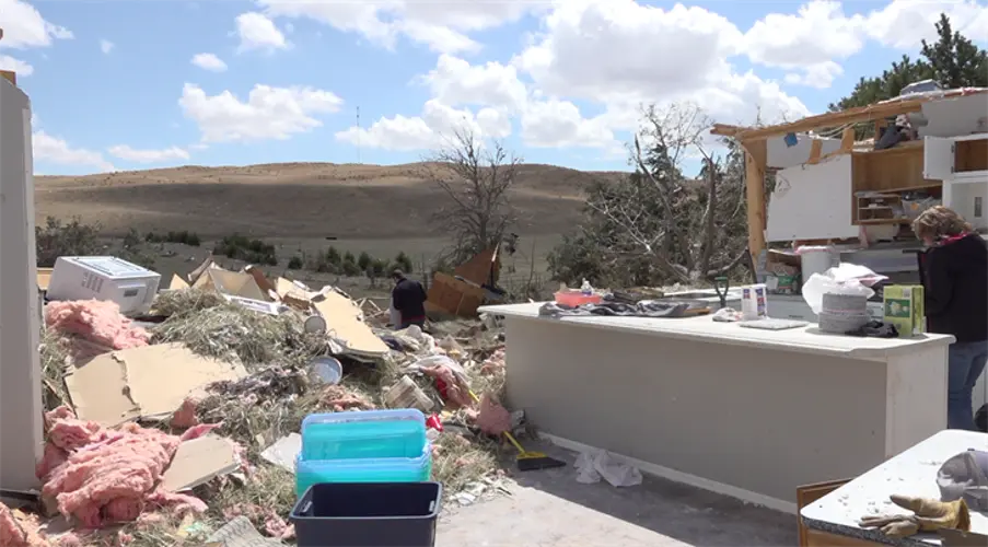
Ashby tornado sets regional record for width

ASHBY, Neb. - The Sunday tornado near Ashby has set a record as the widest tornado ever surveyed in the North Platte National Weather Service (NWS) county warning area, according to preliminary information released by NWS. Survey teams estimate the tornado was 2200 yards wide. Records maintained by the Storm Prediction Center date back to 1950, making this the widest tornado documented in the region in more than 70 years.
In addition to its record-setting width, the tornado was rated EF2 on the Enhanced Fujita scale, with estimated peak winds of 132 miles per hour. It formed around 6:41 p.m. five miles west-southwest of Bingham and tracked northeast for more than an hour, dissipating around 8:10 p.m. approximately 11 miles north-northeast of Ashby.
NWS say the tornado developed from a supercell thunderstorm that formed in the eastern Nebraska Panhandle late Sunday afternoon, ahead of an approaching surface low pressure system. The storm strengthened as it entered northeastern Garden County, quickly spawning a large tornado near Bingham.
As the tornado moved northeast, NWS reports that it damaged utility poles and trees along Highway 2. Just east of the highway, it struck a farmstead and freight train, causing EF2-level damage. It continued to churn through rural southwest Cherry County, mostly affecting open rangeland.
Photos and videos appear to show smaller satellite tornadoes forming near the main funnel, although no additional damage has been documented so far. The NWS says further tornadoes may be added to the storm report pending additional investigation.
This information remains preliminary and is subject to change.